
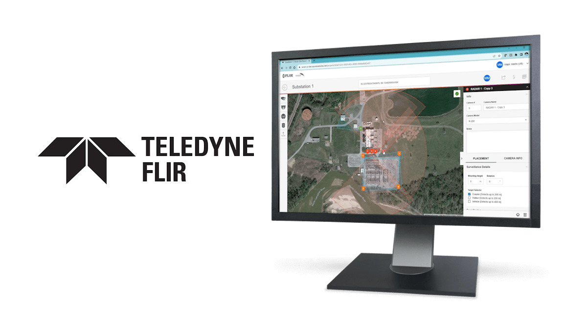
International. The Teledyne FLIR brand has just introduced the latest version of Raven, a simulation and design software that serves as a tool for designing secure sites.
The new version of Raven is designed to quickly identify the correct camera settings to secure a given location. Additionally, the tool uses satellite imagery from Google Maps to make it easy to place FLIR cameras in highly accurate, coordinate-controlled locations, anywhere on the planet.
 "The new tool has a set of controls to simulate mounting height, rotation, range and image detection, so we can ensure satisfactory performance, as well as accurate performance, in the real world," said Matt Strautman, global director of business development, Teledyne FLIR.
Thanks to the innovations introduced, users can access features such as real-time collaboration between users and the introduction of other Teledyne solutions.
"Collaboration is a fundamental part of the user experience offered by Raven, which is why it is possible to share a report with another user to work on a plan in real time. This allows for quick and easy collaboration with partners, customers and colleagues, helping to reduce reviews and time while improving accuracy," added Strautman.
Additional Features
The enhanced software saves time and money by allowing collaborators to stick to the available budget until the site implementation stage. More specifically, visualizing camera coverage allows intelligent deployment to be completed faster and with less risk.
In addition, Raven makes it easy for site planners to swap camera models, before or after creating their design, and then use color-coded detection zones to differentiate the location of radar, thermal, and visible cameras.
The app also provides an enhanced distance calculator with the ability to capture and extend the range of a given camera, directly on the map. It is also possible to add notes from the site plan at the time of camera placement and when generating the final report.
Once the user has created a plan, they can save it to their projects folder and then create a PDF output that includes details of each camera, the GPS coordinates, and the overall map of the satellite plan.


Leave your comment